cookieless, no-ads, no threats canyon exploring with
Michele Angileri
Torrente San Leo
- News
- Canyons by area
- Guidebook: I canyon del Lazio (italian language)
- Ultralight ropes canyoning technique
- Which canyoning?
- Home

The little village of San Morello rises one of the rocky peaks of the hills between Cariati and Scala Coeli, overlooking the Ionian sea and the fiumara Arso,
coming from the nearby slopes of Sila range.
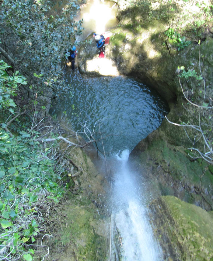
Not far from the village, the San Leo creek descends towards the sea with waterfalls and gorges surrounded by a splendid and wild Mediterranean vegetation.
| Name | Torrente San Leo |
| Area | Calabria, Sila |
| Nearest village | San Morello |
| Elevation loss | 170 m |
| Length | 1200 m |
| Highest cascade | 20 m |
| Rock | Conglomerate |
| Rating | 2 |
| Shuttle | Possible |
| Explored by | Michele Angileri, Carla Minisci, Saverio Talerico; april 20th 2019 |
Click here to buy passcodes
What you find in the detailed description
I remember ...
Canyons are canyons even where they do not seem so, where the sides are not vertical walls but steep wooden sides that look easy to climb ...
We stopped for the sandwich about halfway down the gorge. Immediately upstream of a waterfall there was a widening bordered by a net on left side.
There was an abandoned path beyond the net, which certainly served to prevent cattle from reaching the edge of the waterfall.
Grazing cattle, paths, a net ... evidently up until a few years ago that side of the gorge was used as a pasture ground.
At the end of the gorge we noticed that we had lost a rope, an old piece of 20 m stored into a bag. It wasn't a big loss, however. Probably we had pulled it out of the
backpack in the lunch stop and left it there, near the net closing that old path.
With the aim to retrieve the rope and, mostly, the bag, to verify the accessibility and the existence of paths on the left side of the gorge, and also
for the pure pleasure of taking a walk, I decided with Saverio to try it.
But first I looked closely at satellite photos looking for the sign of the path, and from the images the slope did not seem so accessible ...
However, I obtained a GPS track, to be checked on place.
Once on place we realized that GPS track was wrong. The side was very very steep, and there were lots of little walls hidden by the trees.
The billhook was indispensable to move on, but sometimes it was simpler snaking under the branches. Vegetation was
an obstacle but also a protection from the risk of falling down what was in fact a wall.
After a good deal of time and effort we came to what appeared to be a path descending towards the stream. It was the right path, ending at the net, going down
the only accessible point on left side of the gorge, a path made for reaching the tillable grounds above the opposite side of canyon. Rope was there, by the net.
For the return the most logical thing was to follow the path, but this at a certain point disappeared, erased by the vegetation, and so we had to go up "by nose"...
Copyright © 2002- Michele Angileri. All rights reserved.