cookieless, no-ads, no threats canyon exploring with
Michele Angileri
Canale Zagaria

- News
- Canyons by area
- Guidebook: I canyon del Lazio (italian language)
- Ultralight ropes canyoning technique
- Which canyoning?
- Home

Until about fifty years ago, the mountains by the Upper Ionian coast of Calabria were inhabited by farmers and shepherds who lived in scattered farms, connected to each other by a dense network of mule tracks and paths. This was also the case at Mount Sparviere, which with its 1700 m high and its forests guarantees water all year round, and is therefore an optimal place for agro-pastoral life. At some point the farmhouses were close enough to form a kind of village, as in Contrada Zagaria, but for commerce and social life it was necessary to walk 2-3 hours and reach the main villages.
Today the farmhouses are mostly in ruins, surrounded by dense vegetation that has quickly cleared the paths. The only communication routes through the mountain
are the lumberjacks' tracks, often in ruins too, and a couple of battered asphalted streets, still maintained more to affirm the presence of man than for actual
usefulness.
The mountain is much wilder today than it was in the last century, abandoned, reign of a peaceful solitude, a silence broken only by the buzz of cicadas
or by the sound of water flowing at the bottom of the valleys that furrow the mountain.
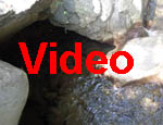
The rocks of these mountains are not compact: marl and flysch break up to make the typical landscape of the fiumare, large river beds made of debris. The bed of the valleys that flow into the rivers is itself detrital, and rarely forms noteworthy waterfalls. In these valleys, canyoning takes on a markedly hiking character. The difficulties come from isolation, the absence of paths, the distance from roads, difficulties in orientation, scorching summer heat, routes' length.
You find all this at Canale Zagaria.
| Name | Canale Zagaria |
| Area | Calabria |
| Nearest village | Plataci |
| Elevation loss | 440 m |
| Length | 3 km |
| Highest cascade | 13 m |
| Rock | Marl, flysch |
| Rating | 4 |
| Shuttle | No |
| Explored by | Lower part: Michele Angileri; august 1998 Upper part: Michele Angileri, Carla Minisci, Saverio Talerico; August 23rd 2020 |
Click here to buy passcodes
What you find in the detailed description
I remember ...
The landscape of Fiumara Saraceno, winding white among the rugged, landsliding, wooded hills, far from the villages and cultivated lands, far from Man,
always fascinated me, since I was a child.
When I became a boy, I began to venture along the Fiumara, without however going too far into that wild environment.
Once I became an adult and a canyoneer I could finally explore every corner of that world, and it was inevitable for me to turn my attention to the rugged
valleys that go steeply down to the Fiumara: Franciardi creek, the Zagaria ...
I was looking for narrow gorges and waterfalls, and I found very few. I descended Canale Zagaria starting at road's bridge.
Although the Zagaria had a couple of gorges, with a few nice pools, the descent hasn't enough to be considered an interesting canyoning route.
A couple of tributaries of Saraceno proved to be even less interesting, so I stopped searching for canyons in Saraceno valley.
Many years later, however, I began to reconsider the Saraceno area. Over the years my idea of canyoning activity had evolved to the point of including less "canonical" routes. Moreover, I realized that I had not taken into consideration some sectors like the upper Zagaria valley, which might hide falls or short gorges. So I went there to see, with Saverio e Carla.
And in this page you can see it too :-)
Copyright © 2002- Michele Angileri. All rights reserved.